Presents excavations at Kingshill South, Cirencester, revealing prehistoric and Roman occupation on the edge of Corinium. Evidence includes late Neolithic or early Bronze Age activity, later prehistoric settlement and Roman-period development in Gloucestershire.
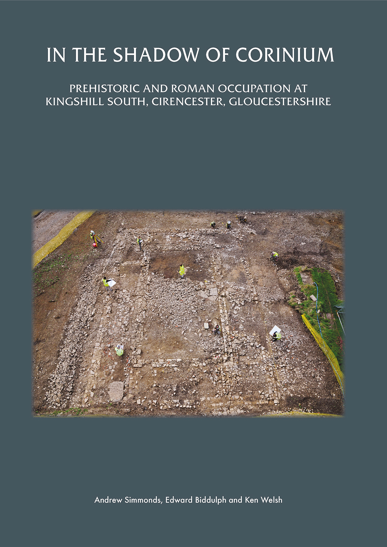
Between 2009 and 2013, Oxford Archaeology carried out an archaeological excavation across an area of c 4.5ha at Kingshill South in Cirencester. The investigations, which were commissioned by CgMs Con - sulting on behalf of Berkeley Homes, were in advance of residential development at the southern edge of the town's eastern suburb, The Beeches, which was being extended onto land that had previously been an area of disused allotments and arable fields. The fieldwork uncovered evidence for activity spanning the prehistoric and Roman periods. Apart from worked flint of Mesolithic date recovered from later contexts, and a group of flint tools once in situ but subsequently eroded into a later ditch, the earliest evidence for activity was a single pit dating to the late Neolithic period or early Bronze Age. A settlement comprising a post-built roundhouse, a possible second structure, and an associated fenceline was established during the late Bronze Age-early Iron Age Following a hiatus in occupation, an arrangement of rectilinear fields defined by ditches was laid out across part of the southern slope during the late 1st century AD. The resulting upper and lower enclosures represent the southern limit of a more extensive estate situated on the western slope overlooking the River Churn. The lower enclosure was divided into a series of subsidiary enclosures that presumably served some agricultural function, perhaps as paddocks for livestock. The upper enclosure was largely devoid of internal features. Both enclosures remained in use, though in modified form, until the late 4th century. Three buildings were recorded entirely or partly within the area of the excavation. Building 1, constructed on the edge of the upper enclosure in the 2nd century, was a domestic, stone-footed building comprising a large rectangular room with off-centre hearth, surrounded by a corridor subdivided into small rooms. The building lacked the characteristics typically associated with a villa, such as underfloor heating and tessellated floors, but was clearly a building of some pretension and could be described as a proto-villa. Building 2, built within the lower enclosure also during the 2nd century, was an aisled building with an apsidal end. It was of uncertain function, but it is likely that the building served an agricultural role. Building 3, attributed to the late Roman period based on coin evidence, was not excavated, but was interpreted as a granary from the plan of the exposed parts. Farming was the main economic basis of the settlement, with both crop cultivation and animal husbandry being practised. Spelt wheat and hulled barley were the principal crops. Sheep dominated during the early and middle Roman periods, with cattle became increasingly important over time. Two corndryers were built in the late Roman period. Corinium is likely to have been the main market for the grain, meat, wool and other goods produced at the site. Evidence for craft activity was also recorded, including pin-making and, to a lesser extent, horn-working and smithing. Eleven formal burials, including those of adults and neonates, were encountered across the settlement. Analysis of the remains revealed something of the lives of the settlement's inhabitants. One adult male had become embroiled in fist fights, possibly because of adverse reactions to a facial disfigurement caused by a tumour around his left eye. The habitual, possibly craft-related, activity performed by a young female adult required her to spend much of her time in a squatting position. In addition to the formal burials, disarticulated human bone was recovered from 34 locations. The settlement was abandoned by the late 4th century. The site appears to have been agricultural land until the establishment of Cirencester's eastern suburb, though Ordnance Survey mapping indicates small-scale stone quarries in the area.


 Add to wishlist