
Publishing Scholarly Archaeology since 1997
Publishing Scholarly Archaeology since 1997
Log in | My Account | Basket Twitter Facebook LinkedIn
Advanced Search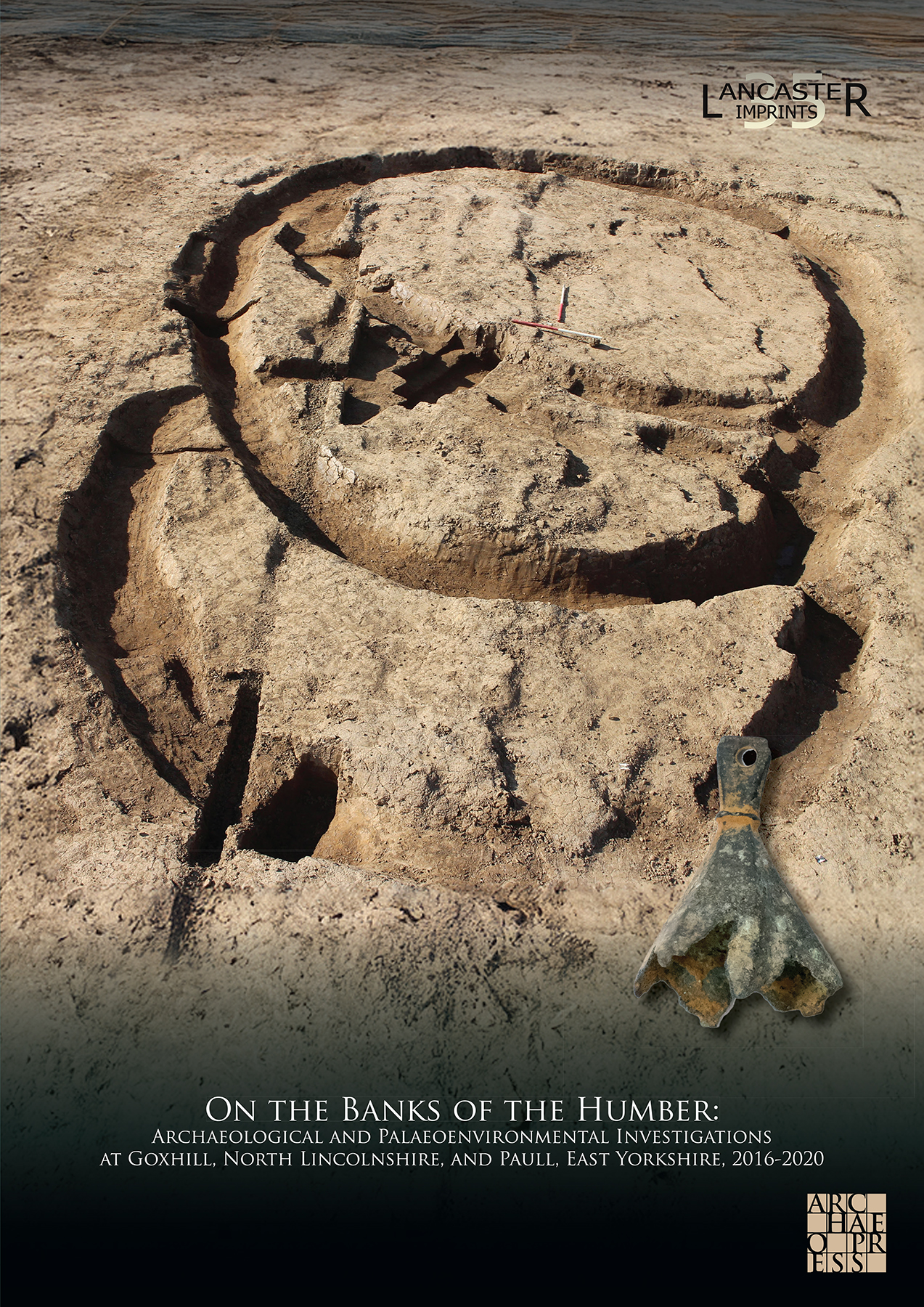
Download Sample PDF
H 297 x W 210 mm
240 pages
Published Jun 2026
ISBN
Paperback: 9781805832539
Digital: 9781805832546
Keywords
Humber Estuary; geoarchaeology; palaeoenvironment; Goxhill; Paull; Iron Age; Roman Britain; medieval settlement; coastal landscape; North Lincolnshire; East Yorkshire
On the Banks of the Humber: Archaeological and Palaeoenvironmental Investigations at Goxhill, North Lincolnshire, and Paull, East Yorkshire, 2016-2020
By Richard Gregory, Stephen Rowland, Mairead Rutherford, John Zant

 Add to wishlist
Archaeological and palaeoenvironmental investigations by Oxford Archaeology reveal the evolving prehistoric coastal landscapes and settlement history of the Humber Estuary. Combining geoarchaeology and excavation, this volume explores Mesolithic to medieval activity at Goxhill, North Lincolnshire and Paull, East Yorkshire.
Contents
1 INTRODUCTION
The Pipeline and its Estuarine Landscapes
Archaeological and Palaeoenvironmental Investigations
Structure of the Volume
Archive
2 EARLY LANDSCAPES AND CHANGING SEA LEVELS
Background
Early Landscapes at Paull and Goxhill
3 PREHISTORIC ACTIVITY AND IRON AGE SETTLEMENT
The Prehistoric Creek and Changing Sea Levels
Late Neolithic/ Bronze Age Activity at the Foreshore
Dividing the Earlier Iron Age Landscape
Later Iron Age Settlement
4 ROMANO-BRITISH SETTLEMENT
Roman Conquest and the Character of Romano-British Settlement
Evolving Romano-British Settlement at Goxhill
5 MEDIEVAL AND POST-MEDIEVAL LANDSCAPES
The Medieval Landscape at Goxhill
The Post-Medieval Landscape at Goxhill
6 CHANGING LANDSCAPES AND SETTLEMENT ON THE BANKS OF THE HUMBER
Early Estuarine Landscapes
Iron Age and Romano-British Settlement at Goxhill
The Medieval and Later Landscape at Goxhill
Conclusion
BIBLIOGRAPHY
INDEX
ONLINE
APPENDIX 1: PREHISTORIC AND ROMAN POTTERY
APPENDIX 2: ORGANIC RESIDUE ANALYSIS
APPENDIX 3: INSECTS AND OTHER INVERTEBRATES
Archaeopress Publishing Ltd
First and Second Floor
13-14 Market Square
Bicester
Oxfordshire OX26 6AD
United Kingdom
Tel +44 (0) 1865 311914 | fax +44 (0) 1865 512231 | email info@archaeopress.com
