Presents post-medieval discoveries from the A21 Tonbridge-to-Pembury scheme, including the Castle Hill Brickworks, Burgess Hill Farm and historic road remains on the Somerhill Estate. Excavation and building recording illuminate estate industry, agriculture and transport.
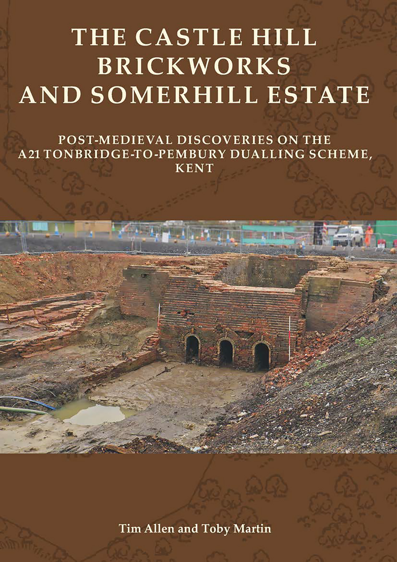
The northern part of the A21 Tonbridge to Pembury Dualling Scheme in Kent ran though the Somerhill Estate, and the dualling of the road resulted in the excavation of the buried remains of the Castle Hill Brickworks, which was established in the early 19th century to serve the estate and continued in use until the 1930s. Further to the south-east, avoidance of the scheduled hillfort on Castle Hill necessitated the removal of Burgess Hill Farm, one of the post-medieval farms attached to the estate. The barn and stables were dismantled and have now been re-erected at the Weald and Downland Living Museum, but the rest of the farm was demolished. In between, excavation of a platform at Burgess Rough adjacent to the A21 revealed a passing place on the slope up to Castle Hill, where elements of the 17th/18th-century road were preserved, and on the other side of the road a turnpike marker post was found in Castle Hill Wood.
The Castle Hill Brickworks contained three kilns, a complex of drying sheds, a workshop and pugmills, together with a cottage, office, clay pits and ponds. One kiln was well preserved, the others had been heavily robbed. Six drying sheds were excavated, together with an L-shaped workshop. Two pugmills were positioned adjacent to the workshop. These open-air pony- or donkey-powered machines were used to mill the raw clay into a smooth and even ‘pug’ before being moulded into bricks. The brick or stone bases of both pugmills were exceptionally well preserved.
Infilled quarry pits for clay were found to the north-west and west of the brickworks. At Castle Hill Wood, to the south, the rising ground had also been quarried for clay, but here quarrying took the form of small terraces dug into the hillside and drainage ditches dug to channel water downslope into a pond used in brickmaking.
At Burgess Rough an earthwork platform was identified during the walkover survey. The earliest feature was a curving ditch just inside the eastern platform edge. Although undated, this ditch was sealed by a thick layer of slowly accumulated colluvium. West of this ditch (and truncating it) was a metalled trackway of two phases. Horseshoes recovered from the earlier phase of use of the track and slag from the earlier metalling indicate a 17th/18th-century date.
To the south, the post-medieval Burgess Hill Farm consisted of a farmhouse, threshing barn, stables and oasthouse. A cattle lodge is also shown on the 1842 tithe map, though it was demolished soon afterwards, and this proved to be a timber, post-built structure. Following the dismantling of the listed barn and stables for re-erection at the Weald and Downland Living Museum, and the recording and demolition of the farmhouse in April 2015, trenches and small areas were excavated to characterise the below-ground remains.
Historic Building report
The farmstead, later called Burgess Hill, was established between 1645 and 1660 after the Somerhill Estate was sequestered during the Commonwealth. By the time the land was recovered the South Frith chase had been disparked and divided into holdings. At Burgess Hill the waste was cleared and a timber‐framed farmhouse was built in a fairly crude fashion on the roadside from much re‐used timber, including some from a medieval building. No archaeological evidence remained to indicate the location of the earliest phase of agricultural buildings although the threshing barn built around a century later also contained medieval timbers, these in their third phase of re‐use.
In the 18th century, the replacement of the front of the house with a brick façade and the construction of the threshing barn and stable indicate the farm was thriving. Some small‐scale dairy production may also have been carried out in the newly‐constructed cellar beneath the house, although this addition caused structural problems for the remainder of the farmhouse’s lifespan.
In 1842, the apportionment and earlier tithe map show that the farm was still in the ownership of the So


 Add to wishlist